


Public transportation scheme
Vilnius city public transportation scheme
Vilnius public transport scheme
Vilniaus viešojo transporto schemoje paprastai, aiškiai ir patogiai pateikta svarbiausia informacija i apie viešojo transporto maršrutus ir infrastruktūrą
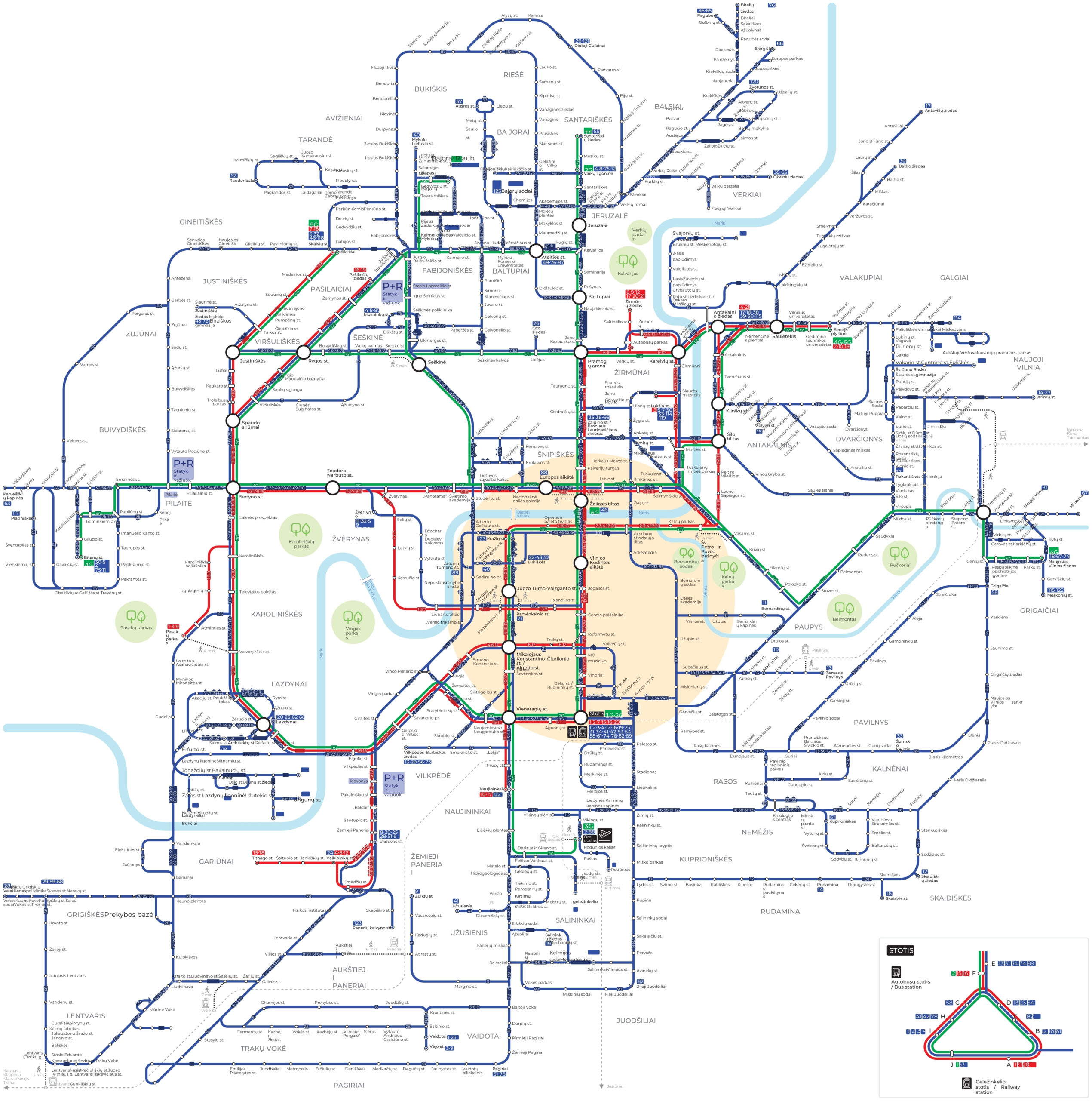
The Vilnius city public transport scheme provides the most important information
 Names of city microdistricts
 Public transport routes and directions
 Public transport stops and their nameslės ir jų pavadinimai
 Public transport interchange points
 Park-and-ride car parks
 Main city points of interest (airport, station, water areas, parks)
 “You are here” marking at the bus stop
and others
Additional explanations
Transfer point
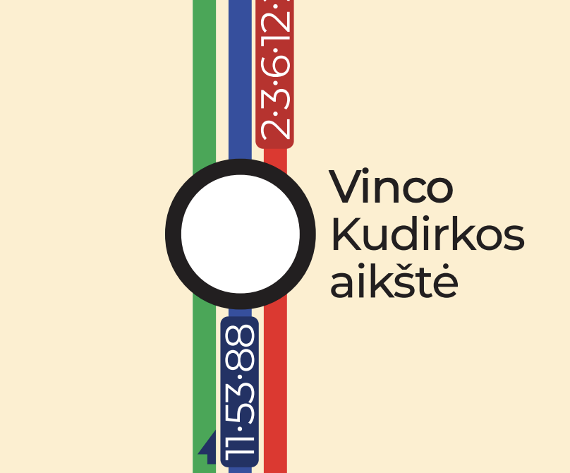
These are public transport stops where different routes intersect. The arrival times of public transport vehicles on all routes are coordinated with each other to ensure a smooth transfer of passengers from one route to another.
Stop identification
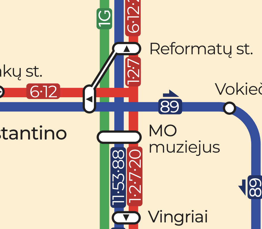
The stop marking shows which routes’ vehicles stop at the stop. For example: Jogailos st. 1G bus does not stop, so the stop marking does not include the green 1G route line.
Triangle in the stop sign and arrow above the route number
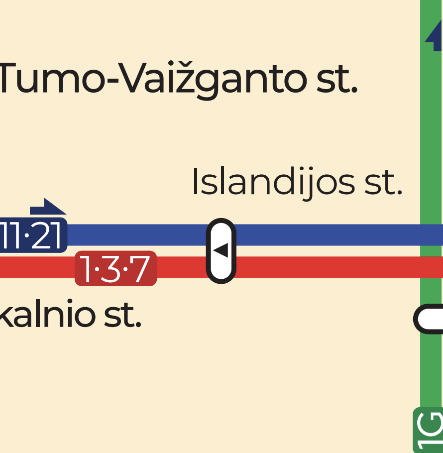
The triangle in the stop sign indicates that the vehicle on a particular route only travels in one direction, which is shown in the diagram. The arrow above the route number indicates that the vehicle on a particular route only travels in one direction.
Time icon and colored stop and route number marking
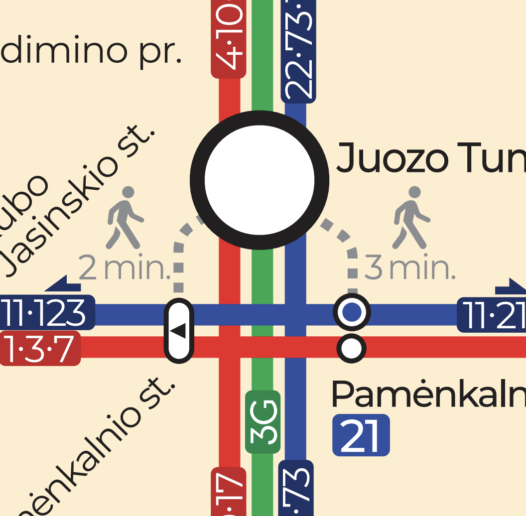
The time icon indicates the walking time from one stop/object to another stop/object. The coloured stop and route number marking indicates that this is the final stop of the route.
Icon for connecting stations

Stotelių sujungimo ikonėlė skirta pavaizduoti galimą persėdimą tarp stotelių, kurios yra nutolusios viena nuo kitos nedideliu atstumu.
The name of the stop is highlighted in purple
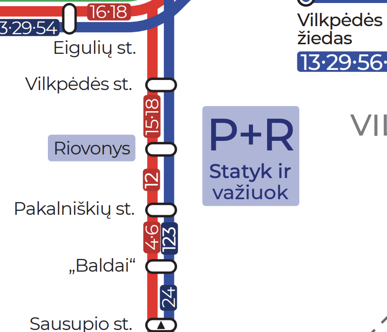
This sign indicates the nearest stop to the Park and Ride (P+R) parking lot.


